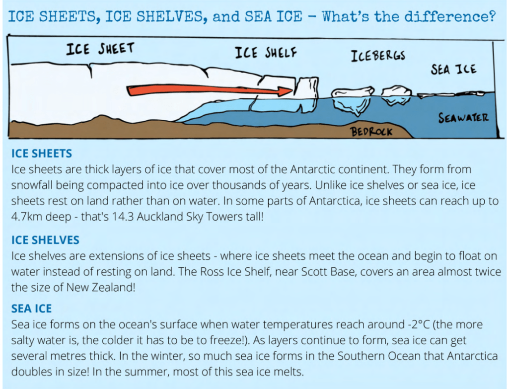
Ice shelf vs ice sheet vs sea ice
The different structural forms around Antarctica are fascinating, and very visible from Scott Base. Scott Base is actually located on Ross Island, in the Ross Sea. It really is an island separate from the continent of Antarctica. It is partly surrounded by the Ross Ice Shelf, which is a permanent establishment of thick ice that does not come and go in a seasonal cycle. Scott Base/Ross Island also experiences the changing sea ice, which does come and go in a seasonal cycle. Word around here is that it doesn’t break into open ocean every year, but it is becoming more common. And an ice sheet is a layer of ice over the continent, which accumulates snow in weather cycles, and as the ice shelf breaks off into icebergs, the ice shelf is still maintained at a constant, fed by the ice sheet of Antarctica.
Around the corner from Scott Base, also on Ross Island, is McMurdo Station (the US research base). It is easier to see from McMurdo that there is open water in the far distance, and eventually the sea ice between there and McMurdo will break out to surround a lot of Ross Island in open water. With that comes close-up views of other marine life like Orcas.
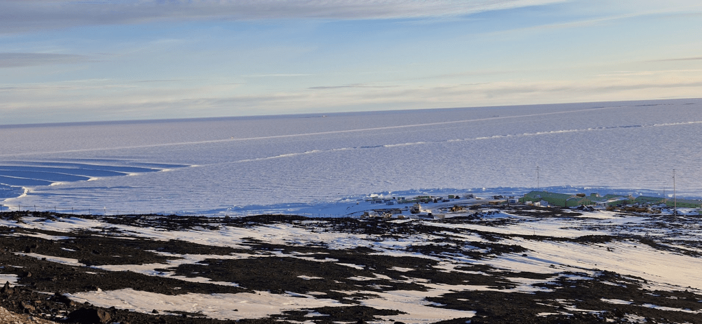
The pressure ridges are formed by the sea ice being pressed up against the land of Ross Island, which are seen right out the front of Scott Base also. In the image below, you can see the foreground is solid land of Ross Island, and Scott Base in the center right. In front of Scott Base are the pressure ridges, and cutting through the middle of the image is the Ross Ice Shelf extending towards the horizon. Between the ice shelf and Scott Base is the sea ice which may or may not become open water over the summer.
The straight line that runs between the ice shelf and the horizon in the image is a road used for transport etc.
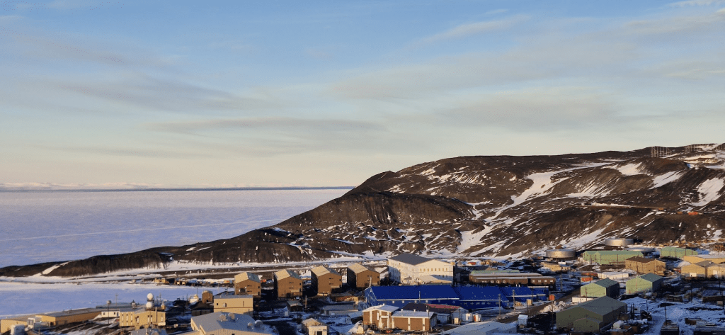
In the next image below, you can see McMurdo Station in the foreground, part of Ross Island in the mid-ground (is that a word?), and along the horizon is a skinny strip of open water. There have been issues with some of the science projects here due to the amount of open water already, where they were expected to deploy and set up camp on the sea ice that should be there instead.
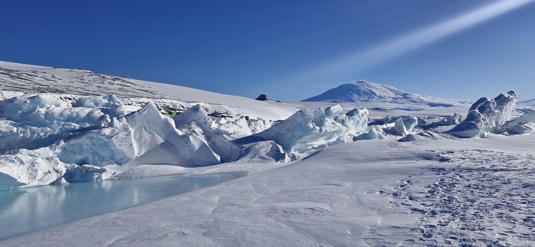
Pressure ridges create gaps in the ice which the seals use to come up on the solid ground and also to go fishing as desired. That’s why there is an established seal colony at Scott Base, due to the ideal geographical patterns around here. You can also see in the image that there is a melt water pond on the left, it is open water that has accumulated on the surface of the sea ice, and they fluctuate with the tides.

Leave a comment